Global Watersheds
🌍 Click on the map to get started.
💻 Downloads
Legend for watershed outlet point:
o Requested
o Snapped to river
![]() About / Help for more information about the app.
© 2022. Contact the author with questions or comments.
Open source code at GitHub.
About / Help for more information about the app.
© 2022. Contact the author with questions or comments.
Open source code at GitHub.
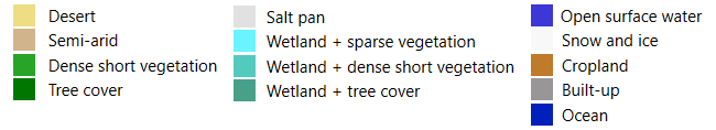
Hover to show land cover

