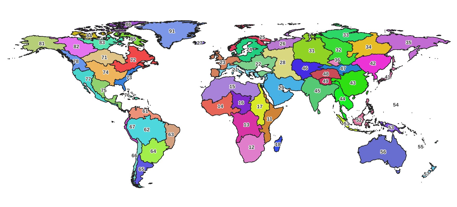
This page contains links to data files for watershed delineation with the delineator Python package.
📌 Please note! The vector data files (*.db) were updated to v3 on July 12, 2026, These are designed to work with delineator version 2.2.4+ You should delete old versions of the .db files and install the latest version of delineator with: pip install --upgrade delineator
The 2-digit number in the file name is the megabasin number, or Pfafstetter Level 2 basin code. You can download files for your region of interest, or all of them if you are working globally. (Right click to view full size.)
The vector data .db files are spatialite-enabled sqlite databases. You can view these data in QGIS or in Python with GeoPandas.
Raster data .tif files are GeoTiffs, and can also be viewed in any GIS software.
To use these with the delineator Python package, put these files into your data folder. See the pacakge docs for how to find or set your data directory. On Windows, it should look like this:
📁 C:\Users\USERNAME\AppData\Local\delineator\
└─ 📁 v3\
	├─ 🗺️ accum11.tif
	├─ 🗺️ accum12.tif
	├─ 📦️ basins11.db
	├─ 📦️ basins12.db
	├─ 🗺️ flowdir11.tif
	├─ 🗺️ flowdir12.tif
	├─ 📦️ rivers11.db
	└─ 📦️ rivers12.db
These data are derived from MERIT-Hydro and MERIT-Basins and are released with the same terms: CC-BY-NC-SA 4.0 license.
To verify the integrity of your download, compare the SHA-256 hash of the file you downloaded against the value in this file: checksums.sha256. For example:
*Note that I've removed the data for Basin 91, covering Greenland. These files are over 5 GB and since Greenland is mostly covered in ice, the results of the watershed delineation algorithms are nonensical.