I’ve set up an API for the watersheds app so you can get watersheds even if you’re not using the web app. You just need to provide a carefully formatted URL. There is a separate link for watershed boundaries and for rivers.
The API returns a GeoJSON string that many applications can use. To use it, you need to provide the latitude and longitude of a watershed outlet, and tell it if you want high-precision or low. (Note that if your watershed has an area of over 50,000 km², the app will automatically revert to low-precision, regardless of what you requested.)
Remember that, just like the regular web app, it can take a while for the app to create large watersheds for the first time. (After they’ve been generated once, the result is cached. Making the same request a second or third time should be fast.)
This feature is experimental and subject to change! Drop me a line and tell me if you are using it for something cool.
Base URLs:
https://mghydro.com/app/watershed_api

https://mghydro.com/app/upstream_rivers_api
Parameters
To be entered as a query string:
lat: a number from -180 to +180

lng: a number from -60 to +85

precision: "low" or "high", without quotes. Optional: if omitted, defaults to "low"
Examples:
https://mghydro.com/app/watershed_api?lat=43.253&lng=-77.609&precision=high

https://mghydro.com/app/upstream_rivers_api?lat=43.253&lng=-77.609&precision=high
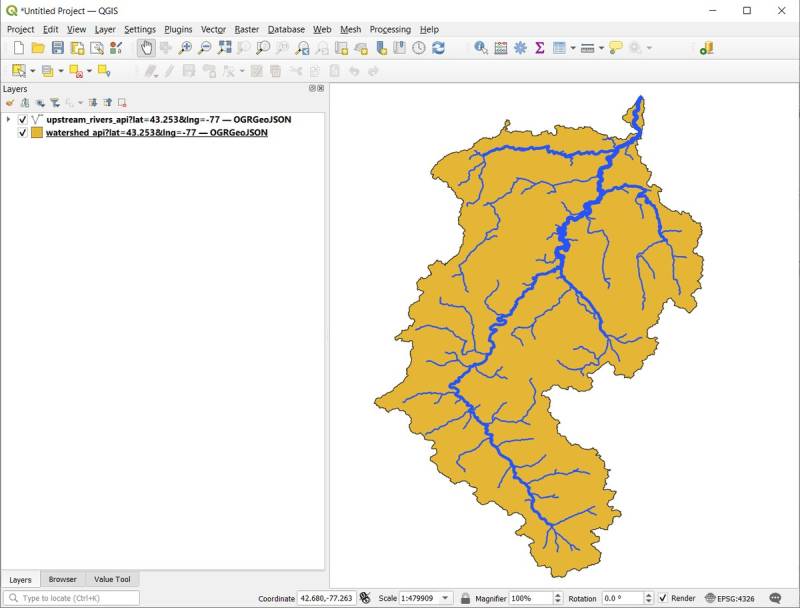
Usage
With the API, you can plug the URL right into QGIS. Choose Layer > Add Layer > Add Vector Layer, then and in the field, “Vector Dataset(s),” add the URL, then click “Add.” Adjust the styles, and you can have something that looks like this: