
The watershed delineation code delineator is now a Python package available on PyPI, the official Python package repository. The best part: it’s totally free and open-source.
This package is based on code that I wrote during my PhD and released on GitHub back in 2022. It enjoyed moderate popularity (I think?) with a few stars and forks. The code has a few nice features that make it fast and efficient compared to other methods. It lets you create huge watersheds using high-resolution data on a laptop. This same task would have required a supercomputer a few years ago.
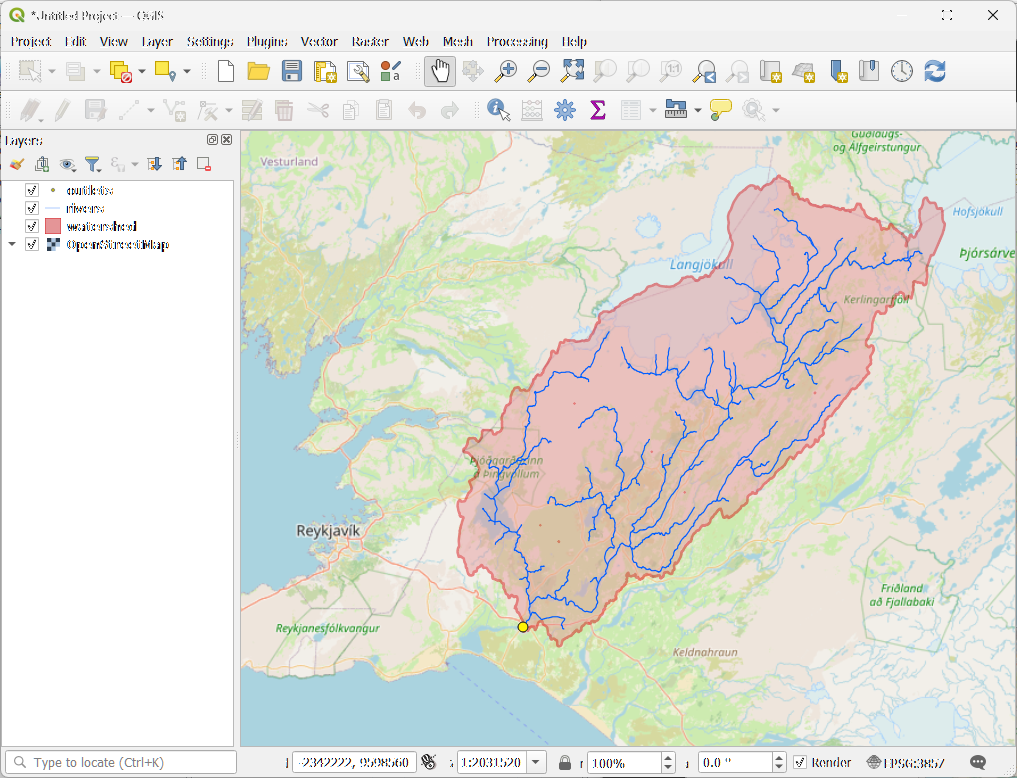
Last year, I submitted a manuscript about the software to a journal, which was rejected. ☹️ Before revising and resubmitting elsewhere, I decided to do a major rewrite of the software to make it easier to install and use. Previously, it was a collection of Python scripts that required careful setup and configuration. Now it’s as simple as running pip install delineator to get started. With just one line of code, you can generate geodata for the watershed boundary and the river network like this:
This code is basically the engine behind the popular Global Watersheds web app. With the delineator Python package, you can do all the calculations on your own machine, with locally hosted data. The package will automatically download the data files that you need at run-time, as long as you are connected to the internet. You can also customize certain parameters that are hard-coded in the web app, making it more flexible. For example, you might want to adjust the pour point snapping threshold, one of the elements that makes watershed delineation and art and a science.
If you’d like to try it out, first make sure you have Python 3.10 or higher installed. Then follow the installation instructions and the Quick Start guide here: https://github.com/mheberger/delineator. Drop me a line if you have any thoughts or feedback about the package!